
Make a donation
Gear up for your next adventure:
As an Amazon Associate, this site earns from qualifying purchases at no extra cost to you.
La Apartada topographic map
Click on the map to display elevation.
Make a donation
Gear up for your next adventure:
As an Amazon Associate, this site earns from qualifying purchases at no extra cost to you.
La Apartada
El territorio presenta una topografía poco accidentada, con una altitud promedio de 60 m s. n. m. y con ligeras ondulaciones que no sobrepasan los 200 m s. n. m.
Make a donation
Gear up for your next adventure:
As an Amazon Associate, this site earns from qualifying purchases at no extra cost to you.
About this map
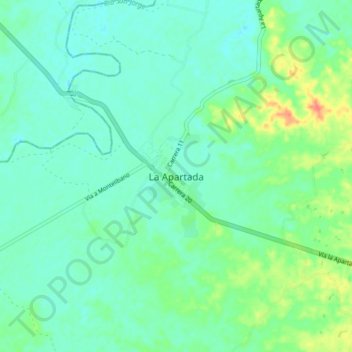
Name: La Apartada topographic map, elevation, terrain.
Location: La Apartada, San Jorge, Córdoba, RAP Caribe, Colombia (8.00847 -75.37365 8.08847 -75.29365)
Average elevation: 128 ft
Minimum elevation: 85 ft
Maximum elevation: 253 ft
Make a donation
Gear up for your next adventure:
As an Amazon Associate, this site earns from qualifying purchases at no extra cost to you.