Geolocate

Plainview topographic map

Click on the map to display elevation.

About this map

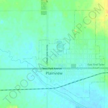
Name: Plainview topographic map, elevation, terrain.

Location: Plainview, Pierce County, Nebraska, 68769, United States (42.34347 -97.80403 42.36536 -97.77629)

Average elevation: 1,703 ft

Minimum elevation: 1,677 ft

Maximum elevation: 1,762 ft

Pierce County trails, hiking, mountain biking, running and outdoor activities

Gear up for your next adventure:

👓Polarized Sunglasses - Outdoor sunglasses for glare reduction
📷Action Camera - Capture your outdoor adventures in HD
🚗GPS Dash Cams - Record your scenic drives through mountain passes and canyons
🧢Sun Protection Hats - Wide-brimmed and UPF-rated hats for high-altitude sun safety
📦Dry Bags Set - Waterproof storage for electronics and clothes

As an Amazon Associate, this site earns from qualifying purchases at no extra cost to you.