Geolocate

Jerte topographic map

Click on the map to display elevation.

About this map

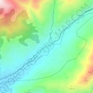
Name: Jerte topographic map, elevation, terrain.

Location: Jerte, Valle del Jerte, Cáceres, Extremadura, 10612, Spain (40.20263 -5.77096 40.24263 -5.73096)

Average elevation: 2,671 ft

Minimum elevation: 1,762 ft

Maximum elevation: 4,754 ft

Gear up for your next adventure:

🔭Telescopic Hiking Pole - Adjustable pole for hiking stability
🚪Portable Camp Chair - Foldable chair for comfort at camp
🧺Microfiber Travel Towels - Compact and fast-drying towels for trail use
🪶Paracord Bracelet - Survival bracelet with built‑in tools
Camping Coffee Makers - Enjoy premium coffee at the summit or campsite

As an Amazon Associate, this site earns from qualifying purchases at no extra cost to you.