Geolocate

Unalaska topographic map

Click on the map to display elevation.

About this map
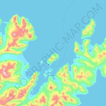
Name: Unalaska topographic map, elevation, terrain.

Location: Unalaska, Unorganized Borough, Alaska, United States (53.80140 -166.77777 54.04989 -166.37169)

Average elevation: 433 ft

Minimum elevation: -16 ft

Maximum elevation: 2,904 ft

Gear up for your next adventure:

☀️Outdoor Sunscreen - High protection sunscreen for outdoor activities
🚁Photography Drones - Capture stunning aerial views of landforms and topography
🛶Inflatable Kayak - Portable kayak for rivers, lakes, and expeditions
🎒Hydration Pack - Hands‑free water reservoir for long hikes
🛰️Handheld GPS Units - Professional satellite navigators for precise backcountry mapping

As an Amazon Associate, this site earns from qualifying purchases at no extra cost to you.