
Thank you for supporting this site ❤️
Make a donation
Make a donation
Gear up for your next adventure:
As an Amazon Associate, this site earns from qualifying purchases at no extra cost to you.
Francisco topographic map
Click on the map to display elevation.
Thank you for supporting this site ❤️
Make a donation
Make a donation
Gear up for your next adventure:
As an Amazon Associate, this site earns from qualifying purchases at no extra cost to you.
About this map
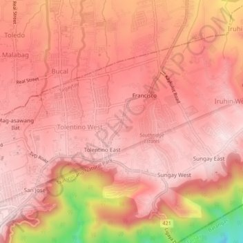
Name: Francisco topographic map, elevation, terrain.
Location: Francisco, Tagaytay, Cavite, Calabarzon, 4120, Philippines (14.11249 120.96295 14.15249 121.00295)
Average elevation: 1,680 ft
Minimum elevation: 656 ft
Maximum elevation: 1,995 ft
Thank you for supporting this site ❤️
Make a donation
Make a donation
Gear up for your next adventure:
As an Amazon Associate, this site earns from qualifying purchases at no extra cost to you.