
Ashbourne topographic map
Click on the map to display elevation.
About this map
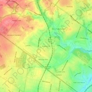
Name: Ashbourne topographic map, elevation, terrain.
Average elevation: 230 ft
Minimum elevation: 79 ft
Maximum elevation: 354 ft
Other topographic maps
Click on a map to view its topography, its elevation and its terrain.
Wyncote
United States > Pennsylvania > Montgomery County > Cheltenham Township > Glenside > Wyncote
Average elevation: 285 ft
La Mott Community Center & Playground
United States > Pennsylvania > Montgomery County > Cheltenham Township > Lamott
Average elevation: 253 ft
Wyncote
United States > Pennsylvania > Montgomery County > Cheltenham Township > Glenside > Wyncote
Average elevation: 285 ft