
Hoover topographic map
Click on the map to display elevation.
About this map
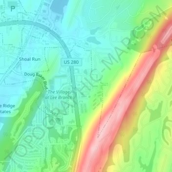
Name: Hoover topographic map, elevation, terrain.
Location: Hoover, Shelby County, Alabama, United States (33.40841 -86.66389 33.40997 -86.66058)
Average elevation: 781 ft
Minimum elevation: 584 ft
Maximum elevation: 1,175 ft
Shelby County trails, hiking, mountain biking, running and outdoor activities