
Barnegat Township topographic map
Interactive map
Click on the map to display elevation.
About this map
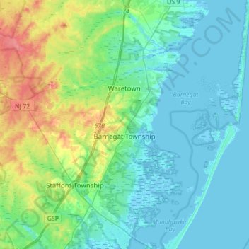
Name: Barnegat Township topographic map, elevation, terrain.
Average elevation: 46 ft
Minimum elevation: -10 ft
Maximum elevation: 200 ft
Ocean County trails, hiking, mountain biking, running and outdoor activities
Other topographic maps
Click on a map to view its topography, its elevation and its terrain.
Story Island Channel
United States > New Jersey > Ocean County > Little Egg Harbor Township
Average elevation: 0 ft