
Thank you for supporting this site ❤️
Make a donation
Make a donation
Gear up for your next adventure:
As an Amazon Associate, this site earns from qualifying purchases at no extra cost to you.
Pastoruri topographic map
Click on the map to display elevation.
Thank you for supporting this site ❤️
Make a donation
Make a donation
Gear up for your next adventure:
As an Amazon Associate, this site earns from qualifying purchases at no extra cost to you.
About this map
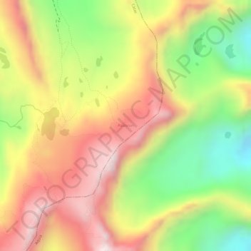
Name: Pastoruri topographic map, elevation, terrain.
Location: Pastoruri, Cátac, Province of Recuay, Ancash, Peru (-9.91625 -77.17901 -9.91268 -77.17526)
Average elevation: 16,270 ft
Minimum elevation: 15,318 ft
Maximum elevation: 17,024 ft
Thank you for supporting this site ❤️
Make a donation
Make a donation
Gear up for your next adventure:
As an Amazon Associate, this site earns from qualifying purchases at no extra cost to you.
Other topographic maps
Click on a map to view its topography, its elevation and its terrain.
Viewpoint crack in mountains shaped like the map of Peru
Average elevation: 13,786 ft