
Dale topographic map
Click on the map to display elevation.
About this map
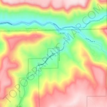
Name: Dale topographic map, elevation, terrain.
Location: Dale, Grant County, Oregon, United States (44.96845 -118.96841 45.00845 -118.92841)
Average elevation: 3,396 ft
Minimum elevation: 2,736 ft
Maximum elevation: 3,983 ft
Grant County trails, hiking, mountain biking, running and outdoor activities
Other topographic maps
Click on a map to view its topography, its elevation and its terrain.
John Day
United States > Oregon > Grant County
John Day is at an elevation of 3,087 feet (941 m). According to the United States Census Bureau, the city has a total area of 1.87 square miles (4.84 km2), all land.
Average elevation: 3,435 ft
Canyon City
United States > Oregon > Grant County
The city is at an elevation of about 3,200 feet (980 m). Between Canyon City and Burns, to the south, Route 395 passes through parts of the Malheur National Forest. According to the United States Census Bureau, the town has a total area of 1.41 square miles (3.65 km2), all land.
Average elevation: 3,537 ft