
Thank you for supporting this site ❤️
Make a donation
Make a donation
Gear up for your next adventure:
As an Amazon Associate, this site earns from qualifying purchases at no extra cost to you.
Mecheria topographic map
Click on the map to display elevation.
Thank you for supporting this site ❤️
Make a donation
Make a donation
Gear up for your next adventure:
As an Amazon Associate, this site earns from qualifying purchases at no extra cost to you.
About this map
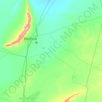
Name: Mecheria topographic map, elevation, terrain.
Location: Mecheria, Mecheria District, Naâma, Algeria (33.33528 -0.42021 33.64338 0.11053)
Average elevation: 3,743 ft
Minimum elevation: 3,451 ft
Maximum elevation: 5,610 ft
Thank you for supporting this site ❤️
Make a donation
Make a donation
Gear up for your next adventure:
As an Amazon Associate, this site earns from qualifying purchases at no extra cost to you.