Geolocate

Elsloo topographic map

Click on the map to display elevation.

About this map

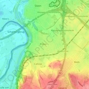
Name: Elsloo topographic map, elevation, terrain.

Location: Elsloo, Stein, Limburg, Netherlands (50.92793 5.71963 50.97220 5.78811)

Average elevation: 220 ft

Minimum elevation: 108 ft

Maximum elevation: 377 ft

Gear up for your next adventure:

🎒Waterproof Dry Bags - Keep your electronics and maps dry inside your pack
🥩Freeze-Dried Meals - Nutritious and lightweight food for remote expeditions
🔦Powerful Headlamps - Ultra-bright hands-free lighting for night navigation
🛠️Outdoor Gear Repair Kit - Essential tools to fix gear on the trail
🚪Portable Camp Chair - Foldable chair for comfort at camp

As an Amazon Associate, this site earns from qualifying purchases at no extra cost to you.