Geolocate

Dokkum topographic map

Click on the map to display elevation.

About this map

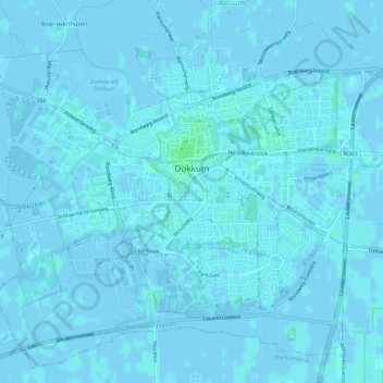
Name: Dokkum topographic map, elevation, terrain.

Location: Dokkum, Noardeast-Fryslân, Frisia, Netherlands (53.30693 5.97067 53.33774 6.02650)

Average elevation: 0 ft

Minimum elevation: -10 ft

Maximum elevation: 16 ft

Gear up for your next adventure:

🧭Hiking Compass - Precision compass for reliable navigation in the wilderness
🪓Survival Multi‑Tool - Versatile tool for camp and trail tasks
🩳Quick‑Dry Hiking Shorts - Comfortable and quick‑dry shorts for summer hiking
🪶Camp Gear Gift Set - Perfect gift bundle for outdoor fans
🪶Compact Camp Shovel - Folding shovel for campsite tasks

As an Amazon Associate, this site earns from qualifying purchases at no extra cost to you.