
Thank you for supporting this site ❤️
Make a donation
Make a donation
Gear up for your next adventure:
As an Amazon Associate, this site earns from qualifying purchases at no extra cost to you.
Cerdeiral topographic map
Click on the map to display elevation.
Thank you for supporting this site ❤️
Make a donation
Make a donation
Gear up for your next adventure:
As an Amazon Associate, this site earns from qualifying purchases at no extra cost to you.
About this map
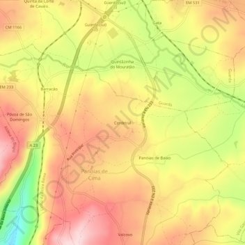
Name: Cerdeiral topographic map, elevation, terrain.
Location: Cerdeiral, Panoias de Cima, Guarda, 6300-539, Portugal (40.48636 -7.24208 40.52636 -7.20208)
Average elevation: 2,694 ft
Minimum elevation: 2,133 ft
Maximum elevation: 3,074 ft
Thank you for supporting this site ❤️
Make a donation
Make a donation
Gear up for your next adventure:
As an Amazon Associate, this site earns from qualifying purchases at no extra cost to you.