Geolocate

Surprise topographic map

Click on the map to display elevation.

About this map

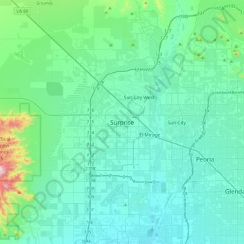
Name: Surprise topographic map, elevation, terrain.

Location: Surprise, Maricopa County, Arizona, 85374, United States (33.46923 -112.52802 33.78923 -112.20802)

Average elevation: 1,345 ft

Minimum elevation: 965 ft

Maximum elevation: 3,976 ft

Maricopa County trails, hiking, mountain biking, running and outdoor activities

Gear up for your next adventure:

🕶️Glacier Sunglasses - Side shields to protect eyes from high-altitude snow glare
🦶Carbon Trekking Poles - Reduce knee impact on steep descents with ultra-light poles
Camping Coffee Makers - Enjoy premium coffee at the summit or campsite
❄️Traction Cleats - Prevent slips on icy trails during winter hikes
🌡️Portable Weather Meter - Track weather conditions on the trail

As an Amazon Associate, this site earns from qualifying purchases at no extra cost to you.