
Thank you for supporting this site ❤️
Make a donation
Make a donation
Gear up for your next adventure:
As an Amazon Associate, this site earns from qualifying purchases at no extra cost to you.
Kharroub topographic map
Click on the map to display elevation.
Thank you for supporting this site ❤️
Make a donation
Make a donation
Gear up for your next adventure:
As an Amazon Associate, this site earns from qualifying purchases at no extra cost to you.
About this map
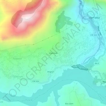
Name: Kharroub topographic map, elevation, terrain.
Location: Kharroub, Kherrata, Kherrata District, Bejaia, 06004, Algeria (36.46014 5.23768 36.50014 5.27768)
Average elevation: 2,306 ft
Minimum elevation: 1,348 ft
Maximum elevation: 4,980 ft
Thank you for supporting this site ❤️
Make a donation
Make a donation
Gear up for your next adventure:
As an Amazon Associate, this site earns from qualifying purchases at no extra cost to you.