
Thank you for supporting this site ❤️
Make a donation
Make a donation
Gear up for your next adventure:
As an Amazon Associate, this site earns from qualifying purchases at no extra cost to you.
Tabio topographic map
Click on the map to display elevation.
Thank you for supporting this site ❤️
Make a donation
Make a donation
Gear up for your next adventure:
As an Amazon Associate, this site earns from qualifying purchases at no extra cost to you.
About this map
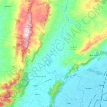
Name: Tabio topographic map, elevation, terrain.
Location: Tabio, Sabana Centro, Cundinamarca, 0000, Colombia (4.89268 -74.13172 5.01121 -74.03616)
Average elevation: 9,094 ft
Minimum elevation: 8,360 ft
Maximum elevation: 10,922 ft
Thank you for supporting this site ❤️
Make a donation
Make a donation
Gear up for your next adventure:
As an Amazon Associate, this site earns from qualifying purchases at no extra cost to you.