Geolocate

Amaga topographic map

Click on the map to display elevation.

About this map

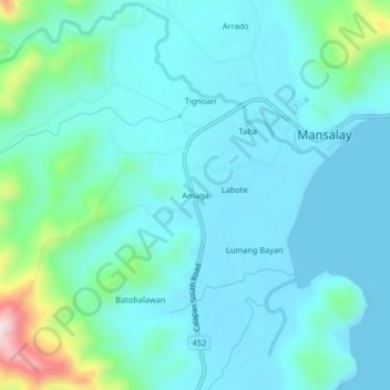
Name: Amaga topographic map, elevation, terrain.

Location: Amaga, Mansalay, Oriental Mindoro, Mimaropa, Philippines (12.49424 121.40541 12.53424 121.44541)

Average elevation: 164 ft

Minimum elevation: 0 ft

Maximum elevation: 1,007 ft

Gear up for your next adventure:

🔦Powerful Headlamps - Ultra-bright hands-free lighting for night navigation
📚USA Hiking Guide Books - Top trail guides and map books
🚁Photography Drones - Capture stunning aerial views of landforms and topography
🛌Ultralight Sleeping Bags - Compact down bags for cold nights in the wilderness
🪶Multi‑Purpose Knife - Useful blade for camp and trail

As an Amazon Associate, this site earns from qualifying purchases at no extra cost to you.