
Thank you for supporting this site ❤️
Make a donation
Make a donation
Gear up for your next adventure:
As an Amazon Associate, this site earns from qualifying purchases at no extra cost to you.
Shedimane topographic map
Click on the map to display elevation.
Thank you for supporting this site ❤️
Make a donation
Make a donation
Gear up for your next adventure:
As an Amazon Associate, this site earns from qualifying purchases at no extra cost to you.
About this map
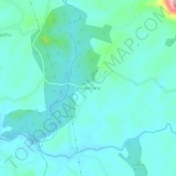
Name: Shedimane topographic map, elevation, terrain.
Location: Shedimane, Hebri taluku, Udupi, Karnataka, 576212, India (13.53366 74.93785 13.57366 74.97785)
Average elevation: 207 ft
Minimum elevation: 108 ft
Maximum elevation: 787 ft
Thank you for supporting this site ❤️
Make a donation
Make a donation
Gear up for your next adventure:
As an Amazon Associate, this site earns from qualifying purchases at no extra cost to you.