
Alturas topographic map
Click on the map to display elevation.
Alturas
Alturas (Spanish for "Heights"; Achumawi: Kasalektawi) is a city and the county seat of Modoc County, California. Located in the Shasta Cascade region of Northern California, the city had a population of 2,715 at the 2020 census. Alturas is located at the confluence of the south and north forks of the Pit River, east of the center of Modoc County, at an elevation of 4,370 feet (1,330 m). Alturas is one of the largest cities in the region and a local economic hub.
About this map
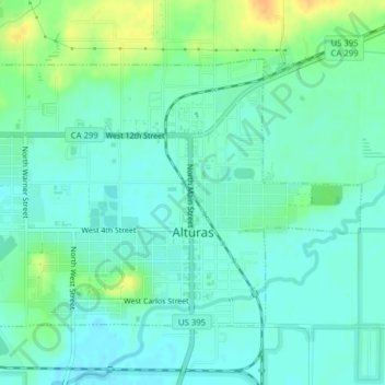
Name: Alturas topographic map, elevation, terrain.
Location: Alturas, Modoc County, California, 96101, United States (41.46870 -120.57572 41.50579 -120.52550)
Average elevation: 4,383 ft
Minimum elevation: 4,354 ft
Maximum elevation: 4,462 ft
Modoc County trails, hiking, mountain biking, running and outdoor activities
Other topographic maps
Click on a map to view its topography, its elevation and its terrain.
Likely
United States > California > Modoc County
Likely (formerly, South Fork) is a census-designated place in Modoc County, California. It is located near the South Fork of the Pit River, 18 miles (29 km) south of the county seat of Alturas, at an elevation of 4,449 feet (1,356 m). Its population is 53 as of the 2020 census, down from 63 at the time of the…
Average elevation: 4,472 ft
California Pines
United States > California > Modoc County
California Pines is a census-designated place in Modoc County, California. It lies at an elevation of 4406 feet (1343 m). Its population is 473 as of the 2020 census, down from 520 from the 2010 census.
Average elevation: 4,393 ft
Likely
United States > California > Modoc County
Likely (formerly, South Fork) is a census-designated place in Modoc County, California. It is located near the South Fork of the Pit River, 18 miles (29 km) south of the county seat of Alturas, at an elevation of 4,449 feet (1,356 m). Its population is 53 as of the 2020 census, down from 63 at the time of the…
Average elevation: 4,472 ft