
Make a donation
Gear up for your next adventure:
As an Amazon Associate, this site earns from qualifying purchases at no extra cost to you.
Hillohe topographic map
Click on the map to display elevation.
Make a donation
Gear up for your next adventure:
As an Amazon Associate, this site earns from qualifying purchases at no extra cost to you.
Hillohe
Aglasterhof | Ballertshofen | Brenzenwang | Brunn | Buschhof | Deinschwang | Dippersricht | Eidelberg | Engelsberg | Eratsmühle | Finsterhaid | Fischermühle | Freiberg | Gebertshofen | Graben | Grafenbuch | Hadermühle | Hansmühle | Hartenhof | Hillohe | Holzheim | Inzenhof | Karlshof | Landnerhof | Lauterhofen | Mantlach | Marbertshofen | Mettenhofen | Mittersberg | Muttenshofen | Nattershofen | Niesaß | Pettenhofen | Ramertshofen | Reitelshofen | Ruppertslohe | Schlögelsmühle | Schweibach | Stieglitzenhöhe | Thürsnacht | Traunfeld | Trautmannshofen | Wilfertshofen
Make a donation
Gear up for your next adventure:
As an Amazon Associate, this site earns from qualifying purchases at no extra cost to you.
About this map
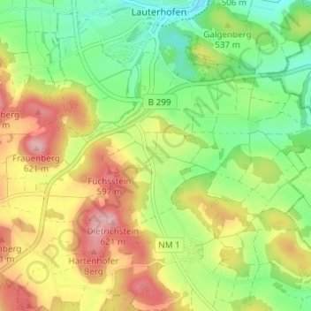
Name: Hillohe topographic map, elevation, terrain.
Average elevation: 1,745 ft
Minimum elevation: 1,526 ft
Maximum elevation: 2,021 ft
Make a donation
Gear up for your next adventure:
As an Amazon Associate, this site earns from qualifying purchases at no extra cost to you.