Geolocate

Tambaram topographic map

Click on the map to display elevation.

About this map

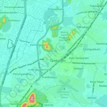
Name: Tambaram topographic map, elevation, terrain.

Location: Tambaram, Chengalpattu District, Tamil Nadu, 600045, India (12.76453 79.95505 13.08453 80.27505)

Average elevation: 75 ft

Minimum elevation: -7 ft

Maximum elevation: 522 ft

Gear up for your next adventure:

🪶Survival Guide Book - Expert advice for emergency preparedness
🧯Emergency Survival Kit - All‑in‑one survival essentials for the backcountry
🚪Portable Camp Chair - Foldable chair for comfort at camp
📖Nature Tracking Books - Learn to track wildlife and terrain
🗺️NatGeo Topo Maps - High-quality waterproof printed topographic maps of US Parks

As an Amazon Associate, this site earns from qualifying purchases at no extra cost to you.