
Make a donation
Gear up for your next adventure:
As an Amazon Associate, this site earns from qualifying purchases at no extra cost to you.
Kala Patthar topographic map
Click on the map to display elevation.
Make a donation
Gear up for your next adventure:
As an Amazon Associate, this site earns from qualifying purchases at no extra cost to you.
Kala Patthar
The views of Everest, Nuptse and Changtse are spectacular from Kala Patthar and there are glimpses of the northern flank and summit of Lhotse. The world's highest webcam, Mount Everest webcam, was located here. Kala Patthar is considered the highest altitude most will reach without a climbing permit, which must be obtained in Kathmandu, at the Nepal Mountaineering Association.
Make a donation
Gear up for your next adventure:
As an Amazon Associate, this site earns from qualifying purchases at no extra cost to you.
About this map
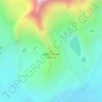
Name: Kala Patthar topographic map, elevation, terrain.
Average elevation: 17,828 ft
Minimum elevation: 16,841 ft
Maximum elevation: 20,620 ft
Make a donation
Gear up for your next adventure:
As an Amazon Associate, this site earns from qualifying purchases at no extra cost to you.
Other topographic maps
Click on a map to view its topography, its elevation and its terrain.