
Thank you for supporting this site ❤️
Make a donation
Make a donation
Gear up for your next adventure:
As an Amazon Associate, this site earns from qualifying purchases at no extra cost to you.
Tequesquitengo topographic map
Click on the map to display elevation.
Thank you for supporting this site ❤️
Make a donation
Make a donation
Gear up for your next adventure:
As an Amazon Associate, this site earns from qualifying purchases at no extra cost to you.
About this map
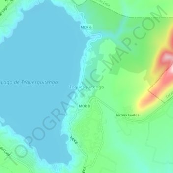
Name: Tequesquitengo topographic map, elevation, terrain.
Location: Tequesquitengo, Jojutla, Morelos, 62909, México (18.59911 -99.27621 18.63911 -99.23621)
Average elevation: 3,091 ft
Minimum elevation: 2,927 ft
Maximum elevation: 3,770 ft
Thank you for supporting this site ❤️
Make a donation
Make a donation
Gear up for your next adventure:
As an Amazon Associate, this site earns from qualifying purchases at no extra cost to you.