
Thank you for supporting this site ❤️
Make a donation
Make a donation
Gear up for your next adventure:
As an Amazon Associate, this site earns from qualifying purchases at no extra cost to you.
Rivodora topographic map
Click on the map to display elevation.
Thank you for supporting this site ❤️
Make a donation
Make a donation
Gear up for your next adventure:
As an Amazon Associate, this site earns from qualifying purchases at no extra cost to you.
About this map
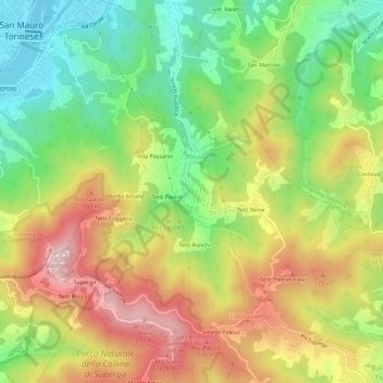
Name: Rivodora topographic map, elevation, terrain.
Location: Rivodora, Baldissero Torinese, Torino, Piemonte, 10099, Italia (45.06753 7.76724 45.10753 7.80724)
Average elevation: 1,378 ft
Minimum elevation: 643 ft
Maximum elevation: 2,254 ft
Thank you for supporting this site ❤️
Make a donation
Make a donation
Gear up for your next adventure:
As an Amazon Associate, this site earns from qualifying purchases at no extra cost to you.