
Braunlauf topographic map
Interactive map
Click on the map to display elevation.
About this map
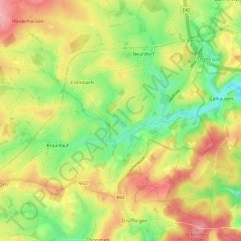
Name: Braunlauf topographic map, elevation, terrain.
Location: Braunlauf, Sankt Vith, Luik, Wallonië, 4780, België (50.24071 6.03117 50.25816 6.12682)
Average elevation: 1,562 ft
Minimum elevation: 1,358 ft
Maximum elevation: 1,781 ft
Other topographic maps
Click on a map to view its topography, its elevation and its terrain.
Heuem
België > Wallonië > Sankt Vith > Heuem
Heuem, Sankt Vith, Luik, Wallonië, 4780, België
Average elevation: 1,585 ft
Die Emmels
België > Wallonië > Sankt Vith
Die Emmels, Sankt Vith, Luik, Wallonië, 4780, België
Average elevation: 1,693 ft