
Myrtle topographic map
Interactive map
Click on the map to display elevation.
About this map
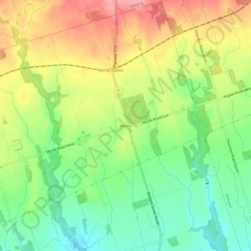
Name: Myrtle topographic map, elevation, terrain.
Average elevation: 827 ft
Minimum elevation: 659 ft
Maximum elevation: 1,024 ft
Other topographic maps
Click on a map to view its topography, its elevation and its terrain.
Corbett Creek
Canada > Ontario > Durham Region > Whitby
Corbett Creek, Whitby, Durham Region, Golden Horseshoe, Ontario, L1J 6W7, Canada
Average elevation: 331 ft
Corbett Creek
Canada > Ontario > Durham Region > Whitby
Corbett Creek, Whitby, Durham Region, Golden Horseshoe, Ontario, Canada
Average elevation: 272 ft