
Wermsdorf topographic map
Interactive map
Click on the map to display elevation.
Wermsdorf
There are numerous cycling routes of low elevation and trail-ways suitable for walking scattered throughout the nearby Wermsdorf Woods. The nearby lakes are available for bathing, boating and fresh water fishing. Wermsdorf also has a number of hostelries for the enjoyment of traditional German food and drink.
About this map
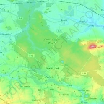
Name: Wermsdorf topographic map, elevation, terrain.
Location: Wermsdorf, Nordsachsen, Saxony, 04779, Germany (51.24084 12.86866 51.35502 13.04971)
Average elevation: 577 ft
Minimum elevation: 430 ft
Maximum elevation: 1,027 ft