
Thank you for supporting this site ❤️
Make a donation
Make a donation
Gear up for your next adventure:
As an Amazon Associate, this site earns from qualifying purchases at no extra cost to you.
Enebyberg topographic map
Click on the map to display elevation.
Thank you for supporting this site ❤️
Make a donation
Make a donation
Gear up for your next adventure:
As an Amazon Associate, this site earns from qualifying purchases at no extra cost to you.
About this map
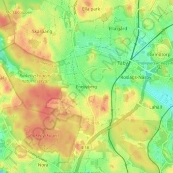
Name: Enebyberg topographic map, elevation, terrain.
Location: Enebyberg, Danderyds kommun, Stockholm County, 182 48, Sweden (59.41123 18.01958 59.45123 18.05958)
Average elevation: 95 ft
Minimum elevation: 0 ft
Maximum elevation: 177 ft
Thank you for supporting this site ❤️
Make a donation
Make a donation
Gear up for your next adventure:
As an Amazon Associate, this site earns from qualifying purchases at no extra cost to you.