
Thank you for supporting this site ❤️
Make a donation
Make a donation
Gear up for your next adventure:
As an Amazon Associate, this site earns from qualifying purchases at no extra cost to you.
G6 topographic map
Click on the map to display elevation.
Thank you for supporting this site ❤️
Make a donation
Make a donation
Gear up for your next adventure:
As an Amazon Associate, this site earns from qualifying purchases at no extra cost to you.
About this map
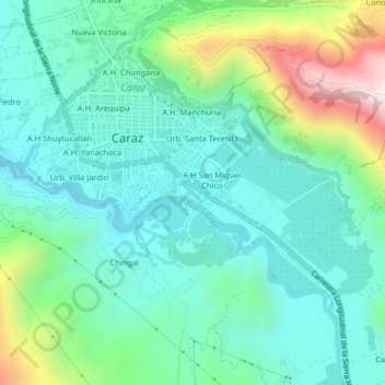
Name: G6 topographic map, elevation, terrain.
Location: G6, Caraz, Huaylas, Áncash, 02165, Perú (-9.07421 -77.82317 -9.03421 -77.78317)
Average elevation: 7,772 ft
Minimum elevation: 7,136 ft
Maximum elevation: 9,678 ft
Thank you for supporting this site ❤️
Make a donation
Make a donation
Gear up for your next adventure:
As an Amazon Associate, this site earns from qualifying purchases at no extra cost to you.
Other topographic maps
Click on a map to view its topography, its elevation and its terrain.