
Pollachi topographic map
Click on the map to display elevation.
Pollachi
Pollachi is located at 10°39′43″N 77°00′23″E / 10.662°N 77.0065°E / 10.662; 77.0065 near the center of the South Indian Peninsula, surrounded by Western Ghats. It has an average elevation of 293 metres (961 ft) on the banks of Aliyar river. The area is hilly and rocky, drained by several rivers and is thickly forested with some marsh lands and scattered patches of grass. The town receives majority of the rainfall from Southwest monsoon arriving through the Palghat gap and receives an average annual rainfall of around 1,274 mm (50.2 in).
About this map
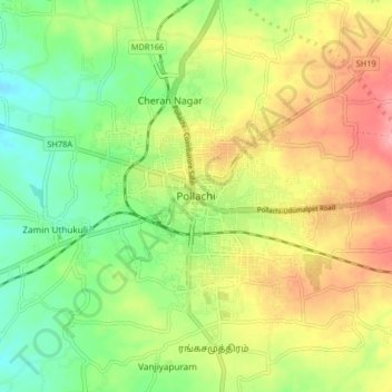
Name: Pollachi topographic map, elevation, terrain.
Location: Pollachi, Coimbatore, Tamil Nadu, 642001, India (10.61882 76.96873 10.69882 77.04873)
Average elevation: 948 ft
Minimum elevation: 784 ft
Maximum elevation: 1,148 ft
Other topographic maps
Click on a map to view its topography, its elevation and its terrain.