Geolocate

Wehutty topographic map

Click on the map to display elevation.

About this map

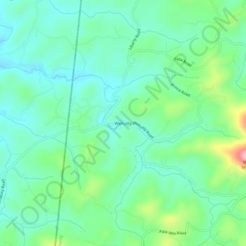
Name: Wehutty topographic map, elevation, terrain.

Location: Wehutty, Cherokee County, North Carolina, United States (35.07397 -84.31714 35.11397 -84.27714)

Average elevation: 1,736 ft

Minimum elevation: 1,549 ft

Maximum elevation: 2,274 ft

Cherokee County trails, hiking, mountain biking, running and outdoor activities

Other topographic maps

Click on a map to view its topography, its elevation and its terrain.

Gear up for your next adventure:

🔦Powerful Headlamps - Ultra-bright hands-free lighting for night navigation
🔥Plasma Lighters - Windproof lighters that work in any weather condition
🌎3D Topographic Globes - Raised relief globes for a tactile understanding of geography
🛠️Outdoor Gear Repair Kit - Essential tools to fix gear on the trail
💧Water Purification System - Clean water on the trail with reliable purifiers

As an Amazon Associate, this site earns from qualifying purchases at no extra cost to you.