Geolocate

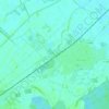
Wingen topographic map

Click on the map to display elevation.

About this map
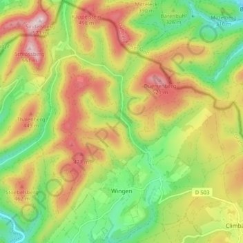
Name: Wingen topographic map, elevation, terrain.

Location: Wingen, Haguenau-Wissembourg, Bas-Rhin, European Collectivity of Alsace, Grand Est, Metropolitan France, 67510, France (49.01433 7.77874 49.06575 7.85511)

Average elevation: 1,145 ft

Minimum elevation: 600 ft

Maximum elevation: 1,772 ft

Other topographic maps

Click on a map to view its topography, its elevation and its terrain.

le Champ du Feu

France > Grand Est > Bas-Rhin > Belmont

Average elevation: 3,100 ft

Erstein-Gare

France > Grand Est > Bas-Rhin > Erstein

Average elevation: 505 ft

Col du Donon

France > Grand Est > Bas-Rhin > Grandfontaine

Average elevation: 2,277 ft

Graufthal

France > Grand Est > Bas-Rhin > Eschbourg

Average elevation: 951 ft

Willigen

France > Grand Est > Bas-Rhin > Kilstett

Average elevation: 427 ft

2te Gewann Neufeld

France > Grand Est > Bas-Rhin > Offendorf

Average elevation: 417 ft

Grande Île

France > Grand Est > Bas-Rhin > Strasbourg

Average elevation: 476 ft

Roed

France > Grand Est > Bas-Rhin > Wingersheim les Quatre Bans > Gingsheim

Average elevation: 748 ft

Su

France > Grand Est > Bas-Rhin > Soultz-les-Bains

Average elevation: 679 ft

Tête Pelée

France > Grand Est > Bas-Rhin > La Broque

Average elevation: 2,205 ft

Kreutzel

France > Grand Est > Bas-Rhin > Baerendorf

Average elevation: 902 ft

Le Hang

France > Grand Est > Bas-Rhin > Bourg-Bruche

Average elevation: 1,903 ft

Gear up for your next adventure:

🧤Tactile Hiking Gloves - Keep hands warm while operating GPS and smartphone screens
🔥Fast-Boil Camping Stoves - Efficient cooking systems for quick trail meals
🌡️Handheld Weather Meters - Measure wind, temp, and pressure for safe mountain travel
🎁Geography Themed Gifts - Unique gift ideas for map lovers and geography enthusiasts
🛠️Backpacking Tool Kit - Essential toolkit for outdoor repairs

As an Amazon Associate, this site earns from qualifying purchases at no extra cost to you.