
Thank you for supporting this site ❤️
Make a donation
Make a donation
Gear up for your next adventure:
As an Amazon Associate, this site earns from qualifying purchases at no extra cost to you.
Mallassery topographic map
Click on the map to display elevation.
Thank you for supporting this site ❤️
Make a donation
Make a donation
Gear up for your next adventure:
As an Amazon Associate, this site earns from qualifying purchases at no extra cost to you.
About this map
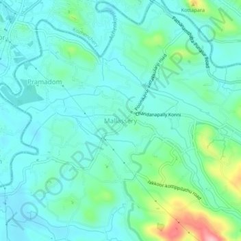
Name: Mallassery topographic map, elevation, terrain.
Location: Mallassery, Konni, Pathanamthitta, Kerala, 689646, India (9.22143 76.78220 9.26143 76.82220)
Average elevation: 135 ft
Minimum elevation: 30 ft
Maximum elevation: 548 ft
Thank you for supporting this site ❤️
Make a donation
Make a donation
Gear up for your next adventure:
As an Amazon Associate, this site earns from qualifying purchases at no extra cost to you.