Geolocate

Batim topographic map

Click on the map to display elevation.

About this map

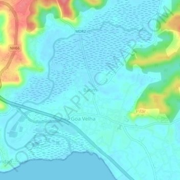
Name: Batim topographic map, elevation, terrain.

Location: Batim, Tiswadi, North Goa, Goa, 403203, India (15.42732 73.86330 15.46732 73.90330)

Average elevation: 49 ft

Minimum elevation: -13 ft

Maximum elevation: 272 ft

Gear up for your next adventure:

Backpacking Tent - Lightweight and durable tent for multi‑day hikes
🦟Ultrasonic Repellers - Create a bug-free zone at your camp or rest stop
🔦Powerful Headlamps - Ultra-bright hands-free lighting for night navigation
👓Polarized Sunglasses - Outdoor sunglasses for glare reduction
🎒Outdoor Daypacks - Lightweight backpacks designed for carrying maps and essential gear

As an Amazon Associate, this site earns from qualifying purchases at no extra cost to you.