
Leeds topographic map
Click on the map to display elevation.
About this map
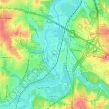
Name: Leeds topographic map, elevation, terrain.
Average elevation: 827 ft
Minimum elevation: 728 ft
Maximum elevation: 981 ft
Jackson County trails, hiking, mountain biking, running and outdoor activities
Other topographic maps
Click on a map to view its topography, its elevation and its terrain.
Richard L. Berkley Riverfront Park
United States > Missouri > Jackson County > Kansas City
Average elevation: 794 ft