
Thank you for supporting this site ❤️
Make a donation
Make a donation
Gear up for your next adventure:
As an Amazon Associate, this site earns from qualifying purchases at no extra cost to you.
Habay topographic map
Click on the map to display elevation.
Thank you for supporting this site ❤️
Make a donation
Make a donation
Gear up for your next adventure:
As an Amazon Associate, this site earns from qualifying purchases at no extra cost to you.
About this map
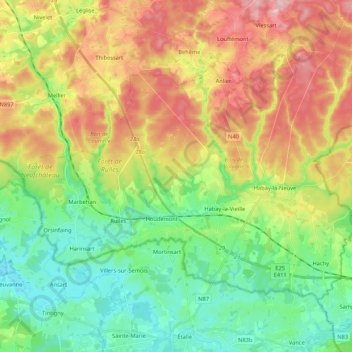
Name: Habay topographic map, elevation, terrain.
Location: Habay, Virton, Luxembourg, Wallonia, Belgium (49.68725 5.50065 49.78399 5.71318)
Average elevation: 1,299 ft
Minimum elevation: 1,056 ft
Maximum elevation: 1,657 ft
Thank you for supporting this site ❤️
Make a donation
Make a donation
Gear up for your next adventure:
As an Amazon Associate, this site earns from qualifying purchases at no extra cost to you.