
Quail Lake topographic map
Click on the map to display elevation.
About this map
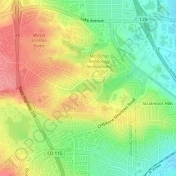
Name: Quail Lake topographic map, elevation, terrain.
Average elevation: 5,965 ft
Minimum elevation: 5,833 ft
Maximum elevation: 6,106 ft
El Paso County trails, hiking, mountain biking, running and outdoor activities
Other topographic maps
Click on a map to view its topography, its elevation and its terrain.
Garden of the Gods
United States > Colorado > El Paso County > Colorado Springs
Average elevation: 6,463 ft
Stratton Meadows
United States > Colorado > El Paso County > Colorado Springs
Average elevation: 5,968 ft