
Thank you for supporting this site ❤️
Make a donation
Make a donation
Gear up for your next adventure:
As an Amazon Associate, this site earns from qualifying purchases at no extra cost to you.
Hoyos topographic map
Click on the map to display elevation.
Thank you for supporting this site ❤️
Make a donation
Make a donation
Gear up for your next adventure:
As an Amazon Associate, this site earns from qualifying purchases at no extra cost to you.
About this map
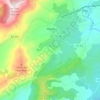
Name: Hoyos topographic map, elevation, terrain.
Location: Hoyos, Sierra de Gata, Cáceres, Extremadura, Spain (40.13315 -6.74791 40.18588 -6.69169)
Average elevation: 1,880 ft
Minimum elevation: 1,194 ft
Maximum elevation: 3,455 ft
Thank you for supporting this site ❤️
Make a donation
Make a donation
Gear up for your next adventure:
As an Amazon Associate, this site earns from qualifying purchases at no extra cost to you.