
Thank you for supporting this site ❤️
Make a donation
Make a donation
Gear up for your next adventure:
As an Amazon Associate, this site earns from qualifying purchases at no extra cost to you.
Salardú topographic map
Click on the map to display elevation.
Thank you for supporting this site ❤️
Make a donation
Make a donation
Gear up for your next adventure:
As an Amazon Associate, this site earns from qualifying purchases at no extra cost to you.
About this map
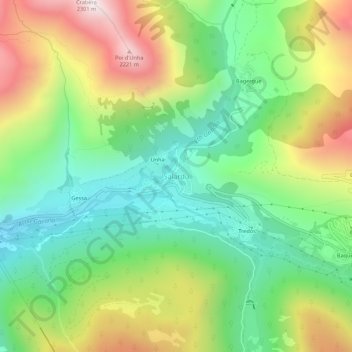
Name: Salardú topographic map, elevation, terrain.
Location: Salardú, Naut Aran, Val d'Aran, Lleida, Catalonia, 25539, Spain (42.68826 0.88499 42.72826 0.92499)
Average elevation: 5,236 ft
Minimum elevation: 3,832 ft
Maximum elevation: 7,484 ft
Thank you for supporting this site ❤️
Make a donation
Make a donation
Gear up for your next adventure:
As an Amazon Associate, this site earns from qualifying purchases at no extra cost to you.