Geolocate

Labo topographic map

Click on the map to display elevation.

About this map

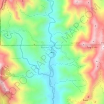
Name: Labo topographic map, elevation, terrain.

Location: Labo, Paquibato, Davao City, Davao Region, 8000, Philippines (7.55475 125.42760 7.59475 125.46760)

Average elevation: 1,709 ft

Minimum elevation: 1,004 ft

Maximum elevation: 2,710 ft

Gear up for your next adventure:

🧭Map Reading Tools - Tools and kits for map navigation
Backpacking Tent - Lightweight and durable tent for multi‑day hikes
🛶Inflatable Kayak - Portable kayak for rivers, lakes, and expeditions
🦟Ultrasonic Repellers - Create a bug-free zone at your camp or rest stop
🚁Photography Drones - Capture stunning aerial views of landforms and topography

As an Amazon Associate, this site earns from qualifying purchases at no extra cost to you.