Geolocate

Pookode topographic map

Click on the map to display elevation.

About this map

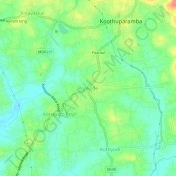
Name: Pookode topographic map, elevation, terrain.

Location: Pookode, Thalassery, Kannur district, Kerala, 670691, India (11.79454 75.53768 11.83454 75.57768)

Average elevation: 92 ft

Minimum elevation: 16 ft

Maximum elevation: 230 ft

Gear up for your next adventure:

🪶Thermal Camp Blanket - Extra warmth for cold nights
🧭GPS Watch Accessories - Bands and chargers for GPS watches
🪵Folding Camp Saw - Compact saw for wood and campsite work
🧭Pro Hiking Compasses - High-accuracy liquid-filled compasses for topographic orientation
💧Water Purification System - Clean water on the trail with reliable purifiers

As an Amazon Associate, this site earns from qualifying purchases at no extra cost to you.