
Floiger topographic map
Click on the map to display elevation.
About this map
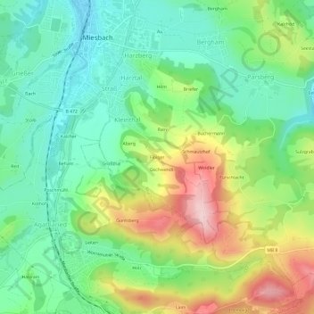
Name: Floiger topographic map, elevation, terrain.
Location: Floiger, Miesbach, Landkreis Miesbach, Bavaria, 83714, Germany (47.75475 11.82480 47.79475 11.86480)
Average elevation: 2,523 ft
Minimum elevation: 2,241 ft
Maximum elevation: 3,035 ft