
Thank you for supporting this site ❤️
Make a donation
Make a donation
Gear up for your next adventure:
As an Amazon Associate, this site earns from qualifying purchases at no extra cost to you.
Mukam topographic map
Click on the map to display elevation.
Thank you for supporting this site ❤️
Make a donation
Make a donation
Gear up for your next adventure:
As an Amazon Associate, this site earns from qualifying purchases at no extra cost to you.
About this map
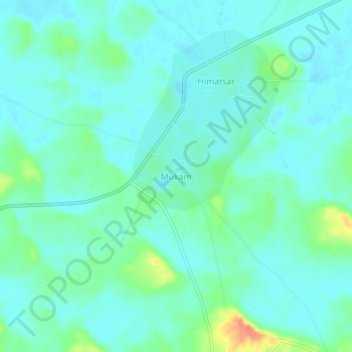
Name: Mukam topographic map, elevation, terrain.
Location: Mukam, Nokha Tehsil, Bikaner, Rajasthan, India (27.60461 73.59810 27.64461 73.63810)
Average elevation: 1,027 ft
Minimum elevation: 991 ft
Maximum elevation: 1,145 ft
Thank you for supporting this site ❤️
Make a donation
Make a donation
Gear up for your next adventure:
As an Amazon Associate, this site earns from qualifying purchases at no extra cost to you.