
Thank you for supporting this site ❤️
Make a donation
Make a donation
Gear up for your next adventure:
As an Amazon Associate, this site earns from qualifying purchases at no extra cost to you.
Millhill topographic map
Click on the map to display elevation.
Thank you for supporting this site ❤️
Make a donation
Make a donation
Gear up for your next adventure:
As an Amazon Associate, this site earns from qualifying purchases at no extra cost to you.
About this map
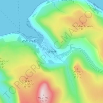
Name: Millhill topographic map, elevation, terrain.
Location: Millhill, North Ayrshire, Scotland, KA27 8HQ, United Kingdom (55.68030 -5.29907 55.72030 -5.25907)
Average elevation: 535 ft
Minimum elevation: 0 ft
Maximum elevation: 1,611 ft
Thank you for supporting this site ❤️
Make a donation
Make a donation
Gear up for your next adventure:
As an Amazon Associate, this site earns from qualifying purchases at no extra cost to you.