Geolocate

Moen topographic map

Click on the map to display elevation.

About this map

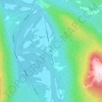
Name: Moen topographic map, elevation, terrain.

Location: Moen, Målselv, Troms og Finnmark, Norway (69.10269 18.59708 69.14269 18.63708)

Average elevation: 328 ft

Minimum elevation: 10 ft

Maximum elevation: 1,729 ft

Other topographic maps

Click on a map to view its topography, its elevation and its terrain.

Balsfjord

Norway > Troms og Finnmark

Average elevation: 1,247 ft

Hammerfest

Norway > Troms og Finnmark

Average elevation: 459 ft

Deatnu

Norway > Troms og Finnmark

Average elevation: 768 ft

Loppa

Norway > Troms og Finnmark

Average elevation: 295 ft

Gear up for your next adventure:

🏫Relief Map Kits - Hands-on tools for teaching landforms and elevation
🪶Compact Camp Shovel - Folding shovel for campsite tasks
🔭Stargazing Telescopes - Perfect for camping in low-light pollution areas shown on maps
📡Handheld GPS Device - Reliable handheld GPS for outdoor navigation
🔋Solar Power Banks - Keep your GPS and phone charged in remote wilderness areas

As an Amazon Associate, this site earns from qualifying purchases at no extra cost to you.