
Thank you for supporting this site ❤️
Make a donation
Make a donation
Gear up for your next adventure:
As an Amazon Associate, this site earns from qualifying purchases at no extra cost to you.
Progled topographic map
Click on the map to display elevation.
Thank you for supporting this site ❤️
Make a donation
Make a donation
Gear up for your next adventure:
As an Amazon Associate, this site earns from qualifying purchases at no extra cost to you.
About this map
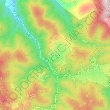
Name: Progled topographic map, elevation, terrain.
Location: Progled, Chepelare, Smolyan, 4870, Bulgaria (41.65769 24.69338 41.69769 24.73338)
Average elevation: 4,810 ft
Minimum elevation: 3,911 ft
Maximum elevation: 5,719 ft
Thank you for supporting this site ❤️
Make a donation
Make a donation
Gear up for your next adventure:
As an Amazon Associate, this site earns from qualifying purchases at no extra cost to you.