
Mananga River topographic map
Interactive map
Click on the map to display elevation.
About this map
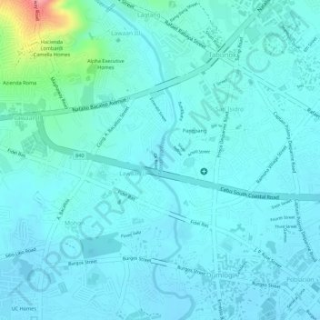
Name: Mananga River topographic map, elevation, terrain.
Location: Mananga River, Talisay, Cebu, Central Visayas, Philippines (10.24302 123.83169 10.26632 123.83717)
Average elevation: 56 ft
Minimum elevation: -3 ft
Maximum elevation: 364 ft
Other topographic maps
Click on a map to view its topography, its elevation and its terrain.
Maghaway
Philippines > Cebu > Talisay
Maghaway, Talisay, Cebu, Central Visayas, 6045, Philippines
Average elevation: 400 ft