
Thank you for supporting this site ❤️
Make a donation
Make a donation
Gear up for your next adventure:
As an Amazon Associate, this site earns from qualifying purchases at no extra cost to you.
Zepperen topographic map
Click on the map to display elevation.
Thank you for supporting this site ❤️
Make a donation
Make a donation
Gear up for your next adventure:
As an Amazon Associate, this site earns from qualifying purchases at no extra cost to you.
About this map
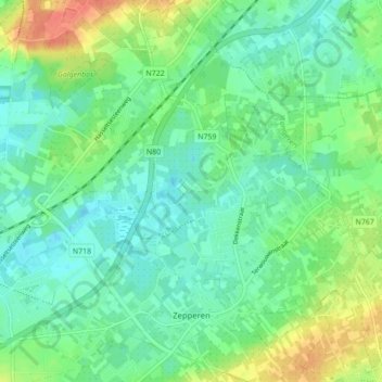
Name: Zepperen topographic map, elevation, terrain.
Location: Zepperen, Sint-Truiden, Hasselt, Limburg, Flanders, Belgium (50.81298 5.23310 50.86765 5.28670)
Average elevation: 171 ft
Minimum elevation: 125 ft
Maximum elevation: 266 ft
Thank you for supporting this site ❤️
Make a donation
Make a donation
Gear up for your next adventure:
As an Amazon Associate, this site earns from qualifying purchases at no extra cost to you.