Geolocate

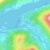
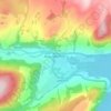
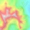
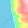
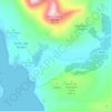
Loch Hourn topographic map

Click on the map to display elevation.

About this map

Name: Loch Hourn topographic map, elevation, terrain.

Location: Loch Hourn, Highland, Scotland, United Kingdom (57.09129 -5.65939 57.14610 -5.48690)

Average elevation: 928 ft

Minimum elevation: -3 ft

Maximum elevation: 3,310 ft

Other topographic maps

Click on a map to view its topography, its elevation and its terrain.
Scottish Highlands

United Kingdom > Scotland > Highland

The entire region was covered by ice sheets during the Pleistocene ice ages, save perhaps for a few nunataks. The complex geomorphology includes incised valleys and lochs carved by the action of mountain streams and ice, and a topography of irregularly distributed mountains whose summits have similar heights…

Average elevation: 2,976 ft
Ben Nevis

United Kingdom > Scotland > Highland

Ben Nevis has a highland (alpine) maritime (oceanic) polar climate (ET climate in the Köppen classification). Ben Nevis's elevation, maritime location and topography frequently lead to cool and cloudy weather conditions, which can pose a danger to ill-equipped walkers. According to the observations carried…

Average elevation: 2,992 ft
Dingwall

United Kingdom > Scotland > Highland

Dingwall (Scots: Dingwal, Scottish Gaelic: Inbhir Pheofharain [ˈiɲɪɾʲ ˈfjɔhəɾɛɲ]) is a town on the Cromarty Firth in Easter Ross in the Highlands of Scotland. It has enjoyed the status of royal burgh since the 13th century, and its local government is the Highland Council. The town has a population…

Average elevation: 308 ft
Inverness

United Kingdom > Scotland > Highland

Average elevation: 535 ft

Glencoe

United Kingdom > Scotland > Highland

Average elevation: 374 ft

Skye

United Kingdom > Scotland > Highland

Beyond Loch Snizort to the west of Trotternish is the Waternish peninsula, which ends in Ardmore Point's double rock arch. Duirinish peninsula is separated from Waternish by Loch Dunvegan, which contains the island of Isay. It is ringed by sea cliffs that reach 296 metres (971 feet) on the west at Waterstein…

Average elevation: 207 ft
Caol

United Kingdom > Scotland > Highland

Average elevation: 125 ft

Hill of Fearn

United Kingdom > Scotland > Highland

Average elevation: 46 ft

Fort William

United Kingdom > Scotland > Highland

Fort William has an oceanic climate (Cfb) with moderate, but generally cool, temperatures and abundant precipitation. In the towns immediate vicinity, there are significant variations in elevation, which leads to some uninhabited areas near the town having a subpolar oceanic climate (Cfc), or, at the absolute…

Average elevation: 400 ft
Aviemore

United Kingdom > Scotland > Highland

Average elevation: 1,086 ft

Drumnadrochit

United Kingdom > Scotland > Highland

Average elevation: 522 ft

Scottish Highlands

United Kingdom > Scotland > Highland

The Scottish Highlands are renowned for their rugged, mountainous terrain that dominates much of the region. Stretching across the northern and central parts of Scotland, the landscape is shaped by ancient geological forces, including the Caledonian Orogeny, which caused significant tectonic collisions…

Average elevation: 2,976 ft
Gairloch

United Kingdom > Scotland > Highland

Average elevation: 253 ft

North Kessock

United Kingdom > Scotland > Highland

Average elevation: 98 ft

the Black Isle

United Kingdom > Scotland > Highland

Average elevation: 269 ft

Sgùrr Alasdair

United Kingdom > Scotland > Highland

Average elevation: 1,890 ft

Lairg

United Kingdom > Scotland > Highland

Average elevation: 423 ft

Fearnmore

United Kingdom > Scotland > Highland

Average elevation: 72 ft

Sgùrr nan Gillean

United Kingdom > Scotland > Highland

Average elevation: 1,627 ft

Tarvie

United Kingdom > Scotland > Highland

Average elevation: 443 ft

Halkirk

United Kingdom > Scotland > Highland

Average elevation: 161 ft

Foyers

United Kingdom > Scotland > Highland

Average elevation: 407 ft

Prince Charles's Stone

United Kingdom > Scotland > Highland > Tomatin > Raigbeg

Average elevation: 1,040 ft
Gartymore

United Kingdom > Scotland > Highland > Portgower

Average elevation: 308 ft

Corry Bruoch Beg

United Kingdom > Scotland > Highland

Average elevation: 1,099 ft

Scourie

United Kingdom > Scotland > Highland

Average elevation: 167 ft

Acharacle

United Kingdom > Scotland > Highland

Average elevation: 151 ft

Drumchork

United Kingdom > Scotland > Highland > Aultbea

Average elevation: 164 ft

Nairn

United Kingdom > Scotland > Highland

Average elevation: 59 ft

Duror

United Kingdom > Scotland > Highland

Average elevation: 423 ft

Brin

United Kingdom > Scotland > Highland > Brin

Average elevation: 928 ft

River Fleet

United Kingdom > Scotland > Highland > Pittentrail

Average elevation: 577 ft

Drimnin

United Kingdom > Scotland > Highland > Bonnavoulin

Average elevation: 272 ft

Achintee

United Kingdom > Scotland > Highland > Strathcarron

Average elevation: 351 ft

Annat

United Kingdom > Scotland > Highland

Average elevation: 499 ft

Gorthleck

United Kingdom > Scotland > Highland

Average elevation: 705 ft

Highlands

United Kingdom > Scotland > Highland

Average elevation: 1,010 ft

Carn Dearg

United Kingdom > Scotland > Highland

Average elevation: 2,333 ft

Mam Sodhail

United Kingdom > Scotland > Highland

Average elevation: 2,874 ft

Spidean Mialach

United Kingdom > Scotland > Highland

Average elevation: 2,041 ft

Mullach Fraoch-choire

United Kingdom > Scotland > Highland

Average elevation: 2,431 ft

Aonach air Chrith

United Kingdom > Scotland > Highland

Average elevation: 2,028 ft

Northwest Highlands

United Kingdom > Scotland > Highland

Considering its high northerly latitude of about 57 to 58 degrees north and the mountainous terrain, the climate is mild, moderated by the warming influence of the North Atlantic Drift which is a powerful warm western boundary current within the Atlantic Ocean that extends the Gulf Stream northeastward. At low…

Average elevation: 2,943 ft

Dornoch Firth

United Kingdom > Scotland > Highland > Ardgay

Average elevation: 200 ft

Raddery

United Kingdom > Scotland > Highland > Fortrose

Average elevation: 423 ft

Corpach

United Kingdom > Scotland > Highland

Average elevation: 272 ft

Ardnarff

United Kingdom > Scotland > Highland

Average elevation: 512 ft

Knoydart

United Kingdom > Scotland > Highland > Inverie

Average elevation: 709 ft

Langdale

United Kingdom > Scotland > Highland

Average elevation: 377 ft

Davochfin

United Kingdom > Scotland > Highland > Dornoch

Average elevation: 43 ft

Melvaig

United Kingdom > Scotland > Highland

Average elevation: 295 ft

Strathpeffer

United Kingdom > Scotland > Highland

It lies in a strath 5 miles (8 km) west of Dingwall, with the elevation ranging from 60 to 120 m (200 to 400 ft) above sea level. Sheltered on the west and north, it has a comparatively dry and warm climate.

Average elevation: 417 ft

Mellon Charles

United Kingdom > Scotland > Highland

Average elevation: 98 ft

Invermoriston

United Kingdom > Scotland > Highland

Average elevation: 696 ft

Newtonmore

United Kingdom > Scotland > Highland

Newtonmore is located within the Cairngorms National Park, approximately 3 miles (5 km) southwest of Kingussie and 15 miles (24 km) southwest of Aviemore. It is on the northeastern bank of the River Spey, between the River Calder and the Allt Lairaidh, at an altitude of approximately 250 metres (820 ft).

Average elevation: 928 ft
Avoch

United Kingdom > Scotland > Highland

Average elevation: 164 ft

Scotscalder

United Kingdom > Scotland > Highland

Average elevation: 236 ft

Wick

United Kingdom > Scotland > Highland

Average elevation: 66 ft

Kingussie

United Kingdom > Scotland > Highland

Average elevation: 1,109 ft

Golspie Burn

United Kingdom > Scotland > Highland > Golspie

Average elevation: 486 ft

Loch Morar

United Kingdom > Scotland > Highland > Morar

Loch Morar (Scottish Gaelic: Loch Mòrair) is a freshwater loch in Lochaber, Highland, Scotland. It is the fifth-largest loch by surface area in Scotland, at 26.7 km2 (10.3 sq mi), and the deepest freshwater body in the British Isles with a maximum depth of 310 m (1,017 ft). The loch was created by glacial…

Average elevation: 387 ft
Insh

United Kingdom > Scotland > Highland

Average elevation: 902 ft

Lyth

United Kingdom > Scotland > Highland

Average elevation: 95 ft

Glasnakille

United Kingdom > Scotland > Highland

Average elevation: 128 ft

Ballachulish

United Kingdom > Scotland > Highland

Average elevation: 525 ft

Clachtoll

United Kingdom > Scotland > Highland

Average elevation: 125 ft

Brae Roy Lodge

United Kingdom > Scotland > Highland

Average elevation: 1,217 ft
Grampian Mountains

United Kingdom > Scotland > Highland

Average elevation: 2,543 ft
Sgùrr na Banachdich

United Kingdom > Scotland > Highland

Average elevation: 1,844 ft
Staffin

United Kingdom > Scotland > Highland

Average elevation: 138 ft

Dounreay

United Kingdom > Scotland > Highland

Average elevation: 118 ft

Inverinate

United Kingdom > Scotland > Highland

Average elevation: 610 ft

Tongue

United Kingdom > Scotland > Highland

Average elevation: 299 ft

Knockdee

United Kingdom > Scotland > Highland

Average elevation: 217 ft

North Watten

United Kingdom > Scotland > Highland

Average elevation: 167 ft

Loch Tarff

United Kingdom > Scotland > Highland

Average elevation: 1,056 ft

Poolewe

United Kingdom > Scotland > Highland

Average elevation: 190 ft

Altnaharra

United Kingdom > Scotland > Highland

Average elevation: 413 ft

Forsinard

United Kingdom > Scotland > Highland

Average elevation: 561 ft

Milovaig

United Kingdom > Scotland > Highland

Average elevation: 236 ft

The Storr

United Kingdom > Scotland > Highland

Average elevation: 1,299 ft

Spean Bridge

United Kingdom > Scotland > Highland

Average elevation: 463 ft

Ardgour

United Kingdom > Scotland > Highland

Average elevation: 771 ft

Gillock

United Kingdom > Scotland > Highland > Wick

Average elevation: 72 ft

Grantown-on-Spey

United Kingdom > Scotland > Highland

Average elevation: 889 ft

Farrmheall

United Kingdom > Scotland > Highland

Average elevation: 922 ft

Laide

United Kingdom > Scotland > Highland

Average elevation: 154 ft

Leanachan Forest

United Kingdom > Scotland > Highland > Torlundy

Average elevation: 328 ft

Aultbea

United Kingdom > Scotland > Highland

Average elevation: 144 ft

Portree

United Kingdom > Scotland > Highland

Average elevation: 397 ft

Kilbride

United Kingdom > Scotland > Highland

Average elevation: 381 ft

Kylesku

United Kingdom > Scotland > Highland

Average elevation: 269 ft

Torridon

United Kingdom > Scotland > Highland

Average elevation: 719 ft

Glenachulish

United Kingdom > Scotland > Highland

Average elevation: 666 ft

Dundreggan

United Kingdom > Scotland > Highland

Average elevation: 820 ft

Achnahaird

United Kingdom > Scotland > Highland

Average elevation: 131 ft

Kinlochewe

United Kingdom > Scotland > Highland

Average elevation: 502 ft

Nethy Bridge

United Kingdom > Scotland > Highland

Average elevation: 755 ft

Gear up for your next adventure:

🛶Inflatable Kayak - Portable kayak for rivers, lakes, and expeditions
🎒Hydration Pack - Hands‑free water reservoir for long hikes
⛺Backpacking Tents - Weight-optimized shelters for multi-day topographic surveys
🦟Ultrasonic Repellers - Create a bug-free zone at your camp or rest stop
🌐World Map Poster - Decorative world maps with topographic info

As an Amazon Associate, this site earns from qualifying purchases at no extra cost to you.